City of Reno - Truckee River High Water Mark
|
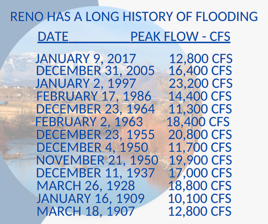
Reno has a Long History of Flooding The High Water Mark at Wingfield Park on January 2, 1997 provides an indication of the magnitude of floods along the Truckee River. Here we show images of past flood events not only as a reminder of the devastating power these floods carry, but to show that these floods have occurred with some regularity since the earliest days of settlement in the region and will continue to inflict heavy damage. It is up to us to best prepare, plan, and take action to ensure for the imminent floods of tomorrow. |
||
Chronology of Significant Flood Events |
||
|
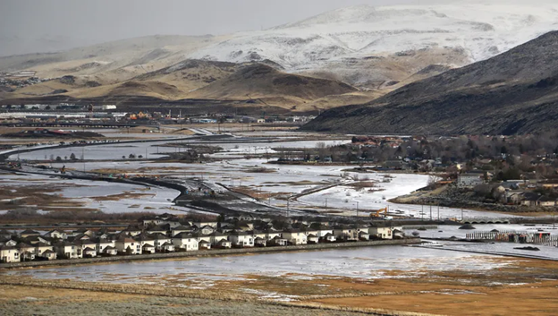
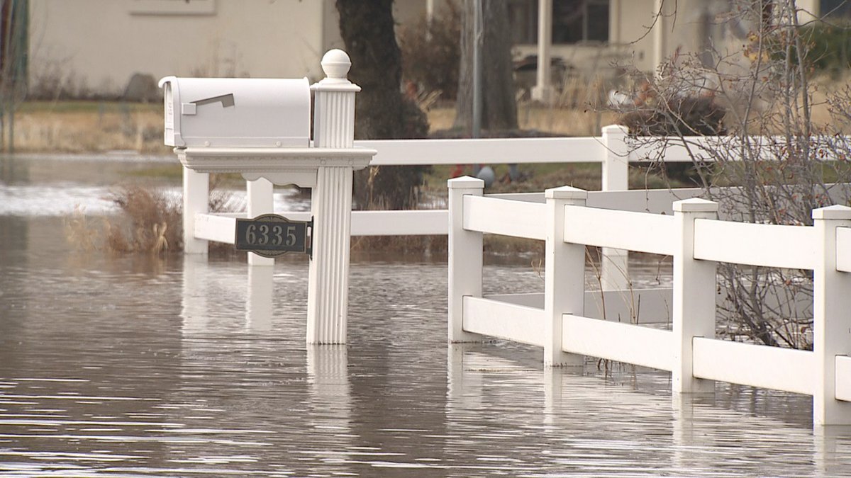
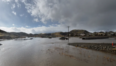
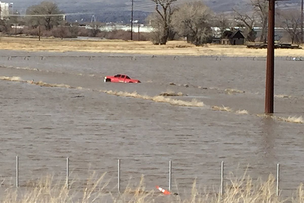
January 9, 2017 - Northern Nevada Flood Event of 2017 The Truckee River in downtown Reno peaked at 12.3 feet at 12:45 a.m. on January 9, 2017. The flood affected many far and wide, across northern Nevada. In one south Reno neighborhood 1,000 residents were voluntarily evacuated. |
||
|
|
||
|
Tributaries flow into Steamboat Creek and join the Truckee River at Vista Narrows, but these flows can also back up at the confluence creating high inundation in the area. |
||
 |
||
| Flooding is seen in the Hidden Valley area of Reno and around the Reno/Sparks Southeast Connector project on Wednesday, Jan. 11, 2017 | ||
|
|
||
 |
||
|
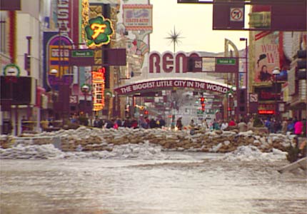
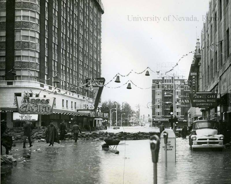
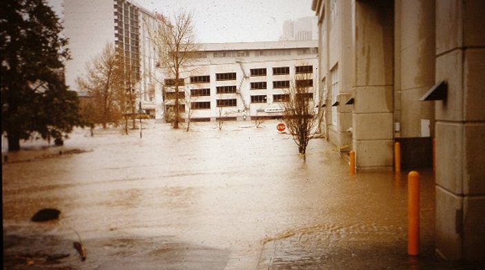
December 31, 2005 - New Year’s Flood of 2005 Also known as the flood of 2006, though the most serious flooding occurred on December 30 – 31, 2005. The storm brought heavy to excessive amounts of precipitation fell on the east slopes from Lake Tahoe east into the Reno metropolitan area. Several gages situated in the mountains and foothills west of Reno and Carson City saw storm totals of 4-6 inches, most of which fell in a 24-hour period. The Truckee River surpassed its designated flood stage in Reno and at Vista. Flood waters spilled into downtown Reno streets and inundated several businesses in the Sparks industrial area. |
||
| Downtown Reno Nevada Flood 2005 NYE video | ||
 |
||
|
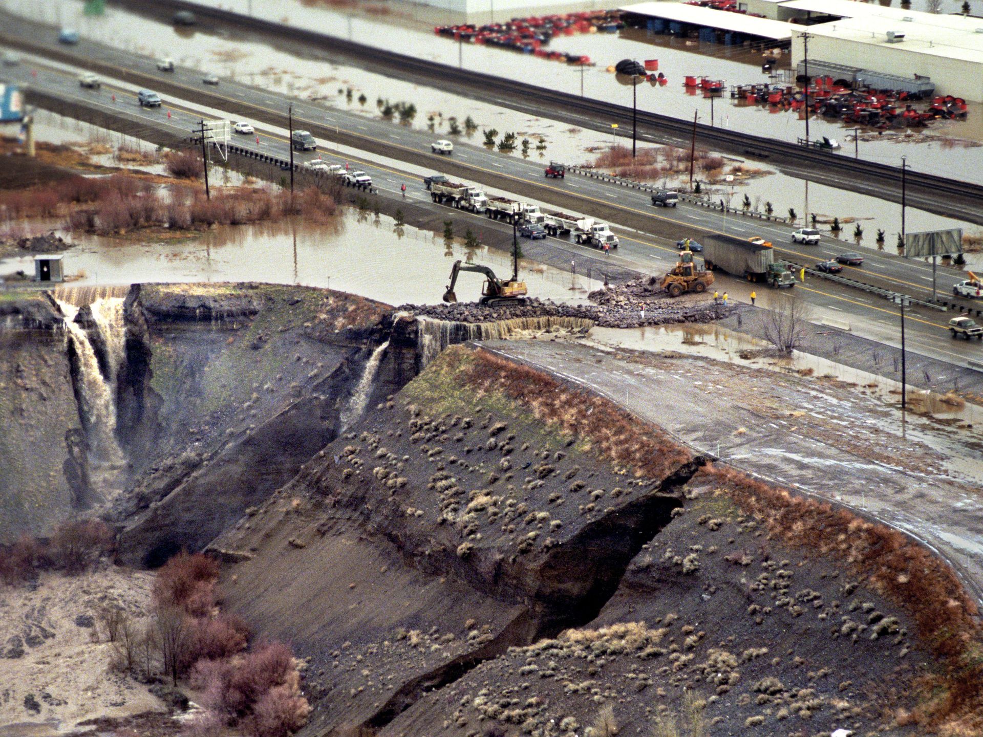
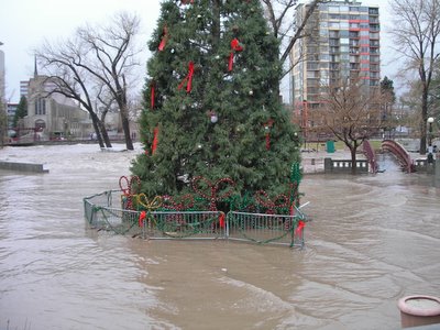
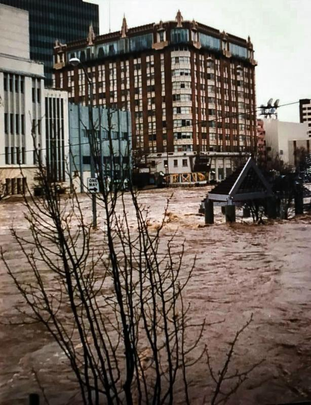
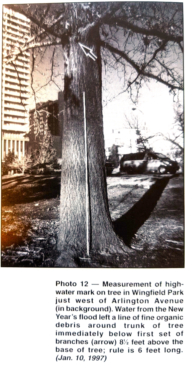
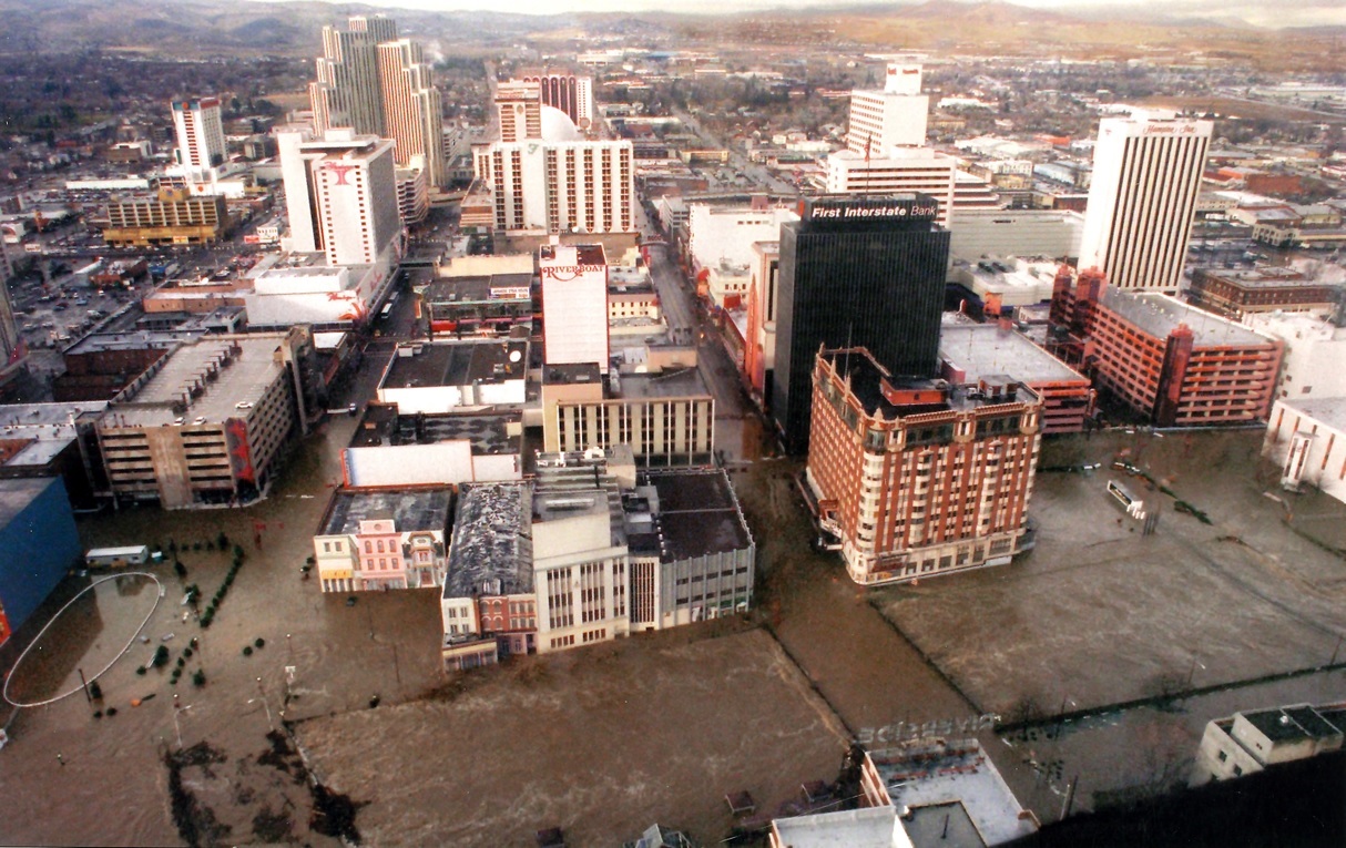
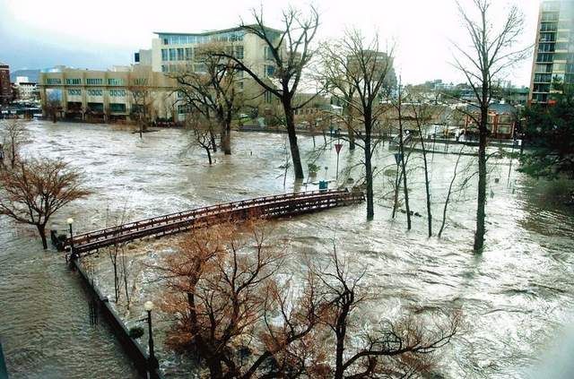
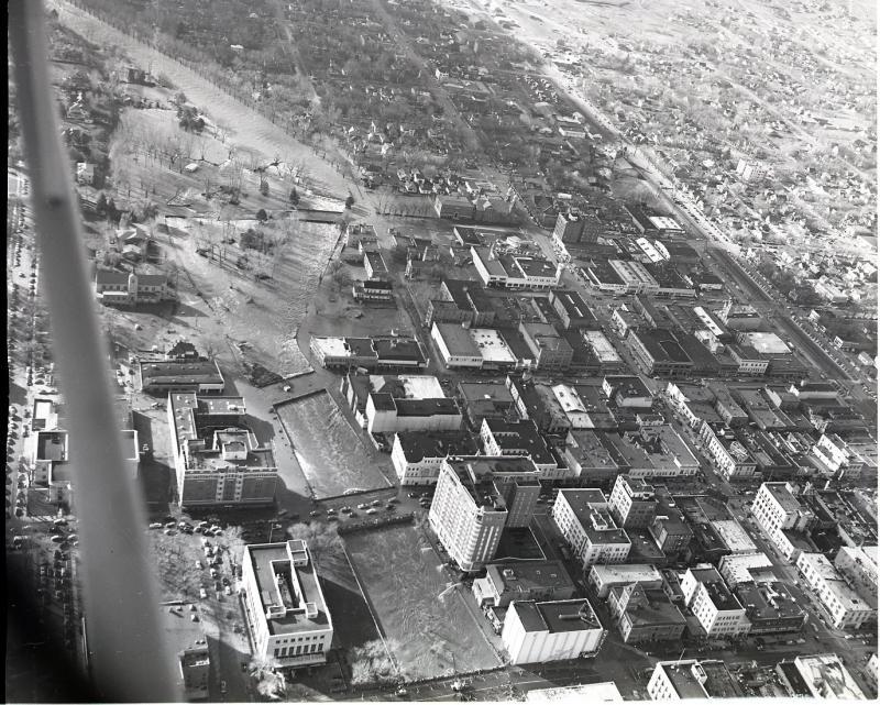
January 2, 1997 - The 1997 New Year's Flood The New Year's floods set new records for peak discharge (flow rate) and maximum stage (water surface height) at several U.S. Geological Survey stream gaging stations along the Truckee River. Although there is dispute over the peak flow rate (USGS lists it at 18,200 cfs, while USACE 23,200 CFS) there no disagreement over the immense destruction the floods caused and at the time was one of the costliest disasters west of the Rockies. After that flood the city and county worked on important changes necessary to cope with future floods. For Reno the improvements led to lower impacts felt by the 2017 flood and marked significant success of their efforts. |
||
 |
||
 |
||
 |
||
|
|
||
|
|
||
 |
||
|
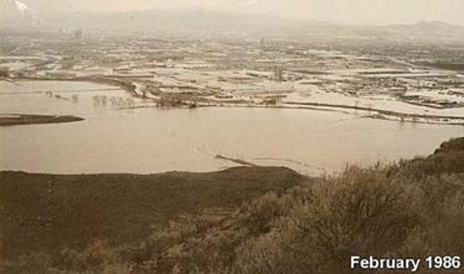
February 17, 1986 The persistent rain and flooding continued unabated and a reminder that floods can cause all sorts of unintended havoc. On Feb. 19, the Truckee River literally exploded. A 12-inch natural gas pipeline underneath the river ruptured near Wadsworth. A plume of escaping gas shot 15 feet into the sky through the muddy torrent. About 42,300 residences and businesses from Fallon to Lake Tahoe were without gas for heating and cooking for more than a week. |
||
 |
||
 |
||
|
December 23, 1964 – The Christmas Flood of 1964 Not the Big Christmas many expected- areas in Oregon, Idaho, California, Washington, and Nevada experienced record-breaking floods caused by three storms between Dec. 19 and Jan. 31. |
||
| 1964 Christmas Flood newsreel | ||
|
February 2, 1963 The Truckee River at Reno crested at 14.4' on February 2, 1963. Heavy precipitation fell for 72 hours. The heavy rainfall quickly filled streams, creeks, and eventually mainstem rivers. |
||
 |
||
|
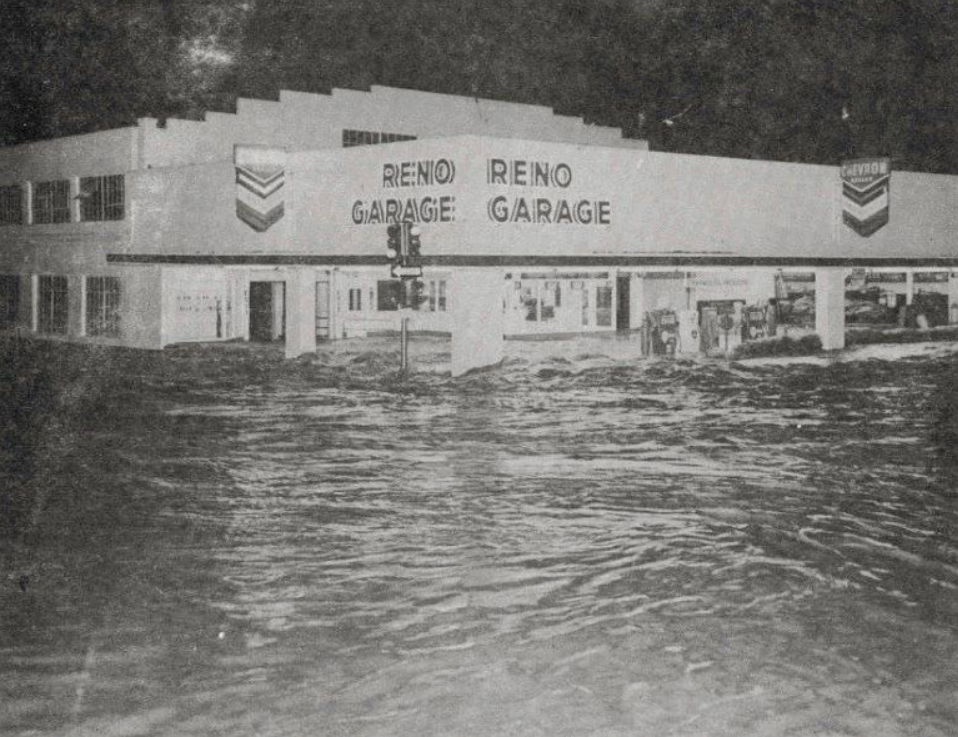
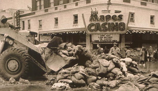
December 23, 1955 - The Christmas Flood of 1955 In one 24-hour period, more than 7 inches of rain fell at the Mt. Rose Highway Station, followed by an additional 4 inches of rain the next day for a 48-hour total of 11.08 inches. After 72 hours the rainfall tally was up to 13.56 inches, which far exceeded any previous records for similar time periods in Nevada. About 6,000 acres were flooded in the Truckee Meadows east of Reno and Sparks. Damages to northern California and northern Nevada were extensive and equivalent to nearly $1 billion today. |
||
 |
||
|
|
||
 |
||
And thank you to our Federal, State, and Local partners for all the dedicated work put into this project |