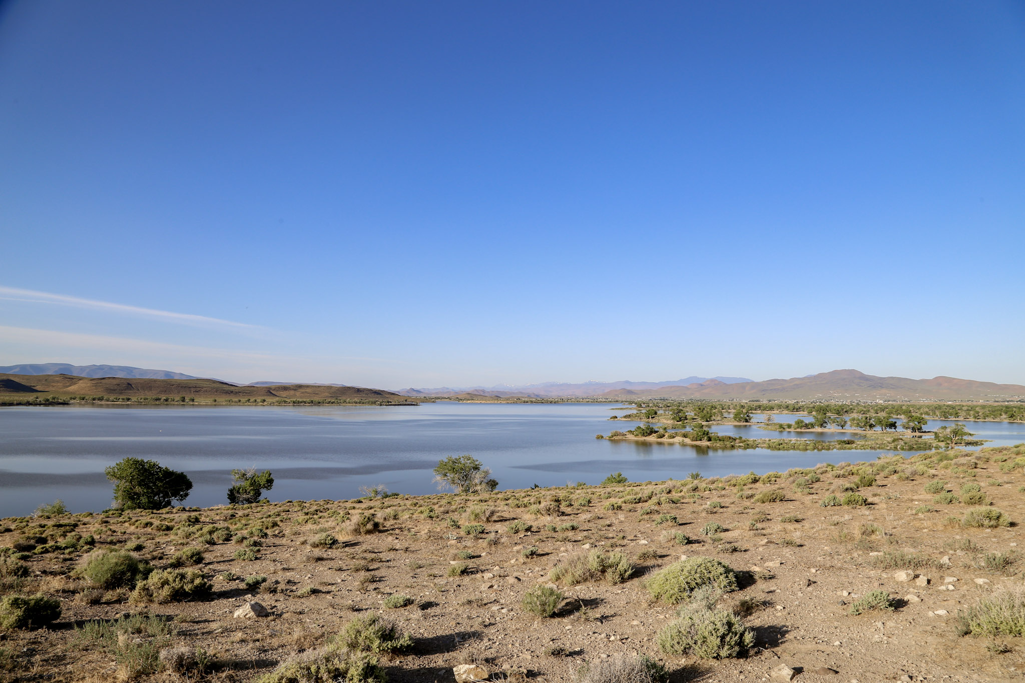
Lahontan State Recreation Area High Water Mark
Lahontan Reservoir- A Long History of Flooding and Agriculture
What is a high water mark?
High water marks indicate where water has reached historically high levels. The Nevada Comprehensive High Water Mark Campaign seeks to educate the public about historic flooding events throughout the state.
Photo of Lahontan Reservoir is courtesy of Tyler Kerver of Nevada Division of State Parks.
Lahontan Reservoir was created in 1915 upon completion of Lahontan Dam under the Newlands Irrigation Project. Construction of the dam lasted 4 years and made history as the first water delivery system built by the federal government. (1)
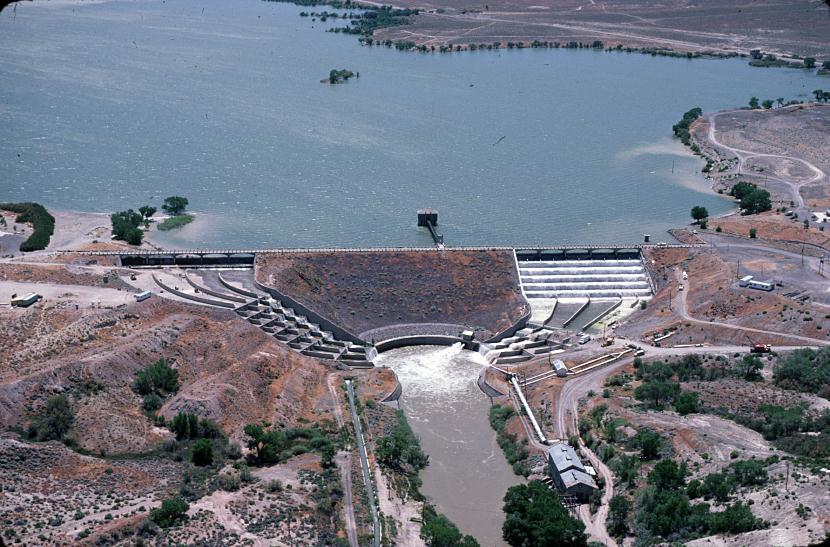
Photo of Lahontan Resrvoir at the Lahontan Dam Spillway (2)
The structure provides a more reliable water source for farmers in the Lahontan Valley, irrigating as much as 30,000 acres. (3) The entire Newlands Project irrigates 73,000 acres.
Located 30 miles south and east of Reno, Lahontan Reservoir receives water from the Carson River, and the Truckee River. Water in Lahontan Reservoir reaches elevations of 4,164 feet, holding roughly 312,000 acre-feet of water (4). For reference, 1 acre-foot is equal to 325,851 gallons or enough water to cover a football field in one foot of water. That means Lahontan Reservoir can hold over 100 billion gallons of water!!!
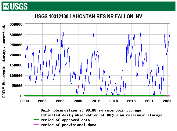
Data collected by the USGS for daily reservoir storage at Lahontan Reservoir. Measurements exceeded 300,000 AF in big water years like 2007, 2011 and 2023 and dipped to nearly nothing during the drought between 2013-2016. Note how quickly storage can fluctuate between these two extremes (4).
Despite this impressive capacity, a season of heavy precipitation can easily fill the reservoir many times over. In 2017, the Truckee-Carson Irrigation District (TCID) faced the challenges of having an overabundance of water in the Carson River, Lahontan Reservoir and the snow pack during springtime runoff. The National Oceanic and Atmospheric Administration estimated that the 2017 snowpack held enough water to fill Lahontan Reservoir 1.3 times when the Reservoir was already nearly full (5). To reduce the risk of flooding downstream, City of Fallon, the TCID, and Churchill County worked together to clear debris from the Carson River and Lahontan Reservoir to increase their capacity and create a channel to release additional water from the reservoir and away populated areas. Dubbed the "Big Dig," the collaborative project completed a new route for water to flow all the way from Lahontan Reservoir to Stillwater Point Reserve (5).
In spring of 2023, the snowpack was even more significant, holding enough water to fill Lahontan Reservoir 2 times (6,7). With the Big Dig Ditch already in place, the TCID was able to keep reservoir levels lower to accommodate a heavier spring runoff. If you want to gain a better understanding of releasing water from a reservoir to accomodate runoff/precipitation, try our Flood Fighter; Nevada video game!
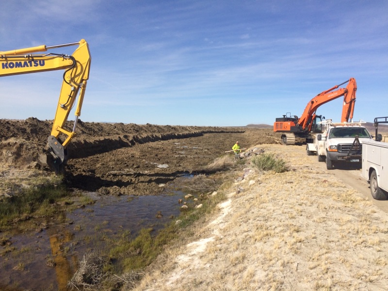
Photo of efforts to create the "Big Dig" Ditch in 2017 to provide a path for water to flow from Lahontan Reservoir to Stillwater Point Reserve. Photo credit: Ernie Shank.
Nevada Was Not Always a Desert
Today, Nevada is the driest state in the nation, but tens of thousands of years ago it was home to a vast lake spanning from the northern border down to Walker Lake and encompassed Pyramid Lake, Black Rock Desert and present-day Lahontan Reservoir.
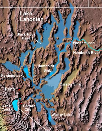
The extent of historic Lake Lahontan. Photo credit: Matthew Trump (8)
One of the highest water elevations recorded at Lahontan Reservoir was ~4162 feet but that is not the highest the water has been at this location... Look up! At it's peak, historic Lake Lahontan was 136 feet above the location of the Lahontan high water mark sign (9,10). If you are standing near the sign, look across the water and observe the horizontal lines marking the slopes around the reservoir and throughout the area. These geologic features, called lake terraces, are created by long periods of wave action and mark pre-historic water levels!
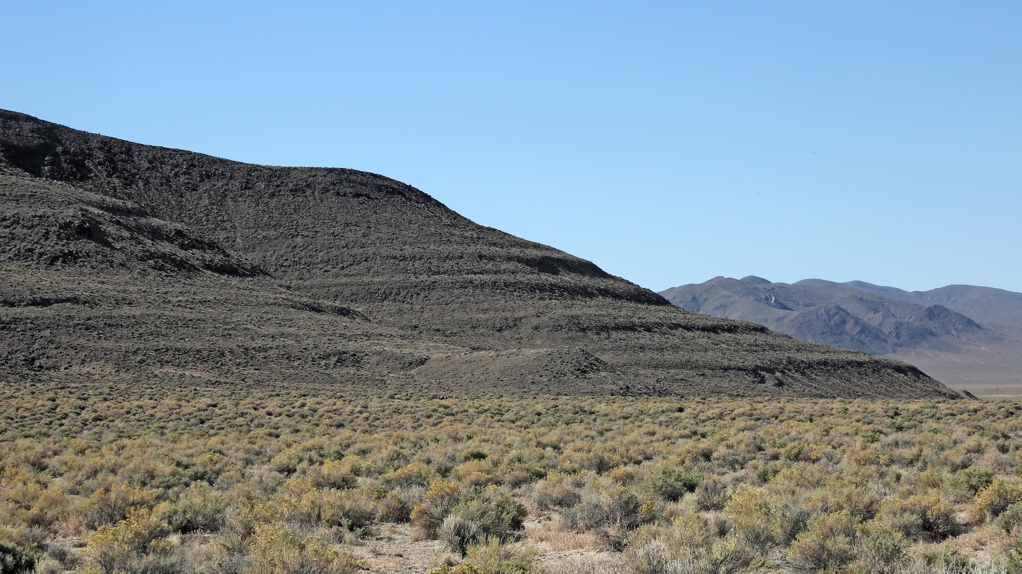
Image of lake terrace lines made by Lake Lahontan on the southwestern slope of the Stillwater Mountains. Photo credit: Ron Wolf.
1) https://www.nps.gov/articles/nevada-lahontan-dam-and-power-station.htm

2) https://commons.wikimedia.org/wiki/File:Lahontan.jpg

3) https://parks.nv.gov/learn/park-histories/lahontan-history#:~:text=Lahontan%20Dam%20and%20reservoir%20are,by%20the%20Bureau%20of%20Reclamation

4) USGS water level gage data: USGS Current Conditions for USGS 10312100 LAHONTAN RES NR FALLON, NV

5) https://www.kunr.org/energy-and-environment/2017-05-16/big-dig-to-protect-fallon-from-expected-flooding

6) https://www.thefallonpost.org/article/5147,high-water-update-why-isn-t-lahontan-reservoir-full

7) https://www.nevadaappeal.com/news/2023/mar/14/tcid-begins-flood-mitigation/

8) License- https://creativecommons.org/licenses/by-sa/3.0/

9) Fisherman's point rough elevation (4,200 ft): https://www.topozone.com/nevada/lyon-nv/reservoir/lahontan-reservoir/

10) Peak Lake Lahontan water elevation (1,330 m or 4,363.5 ft):  https://www.sciencedirect.com/science/article/abs/pii/0033589487900342#:~:text=The%20lake%20appears%20to%20have,12%2C000%20and%2010%2C000%20yr%20B.P.

